odp
241 to 264 of 302 locations
-
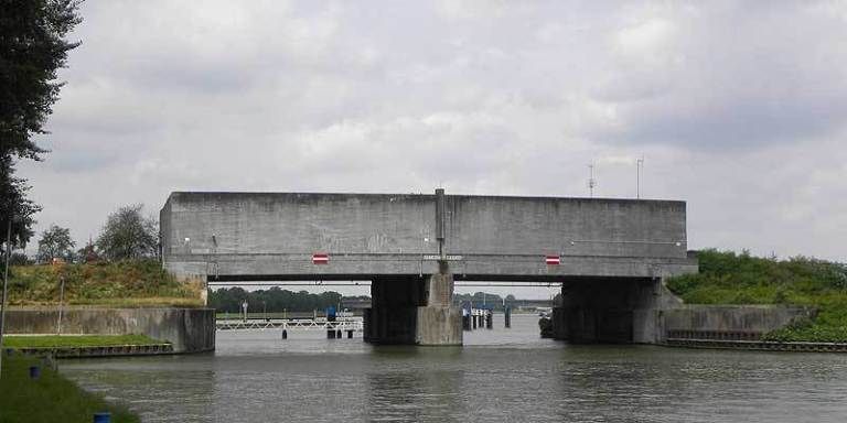
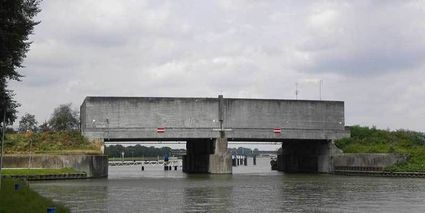
Plofsluis
Plofsluis
The Plofsluis consists of five concrete bins with a relatively weak floor that span the Amsterdam-Rhine Canal. The bins could store around 40,000 tonnes of sand, gravel or debris. In wartime, the floor could be blow up, so that its contents would drop into the Amsterdam-Rhine Canal. This would block the canal and prevent the inundation water from flowing out. The lock was designed in such a way that its sides would remain upright after the explosion, so that the floor could be reconstructed and the sluice could be used again. It was never actually used.
3439 LS Nieuwegein -
-
Molen de Ster
Molen de Ster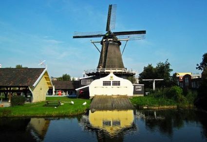
-
Camping De Grebbelinie
Camping De Grebbelinie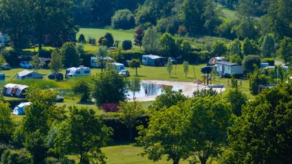
3927 CJ Renswoude -
Fort Uithoorn
Fort Uithoorn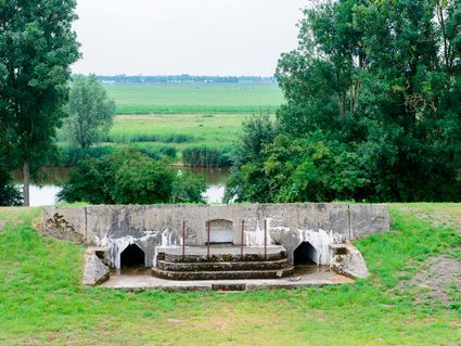
1427 AV Amstelhoek -
Recreatieboerderij De Kleine Weide
Recreatieboerderij De Kleine Weide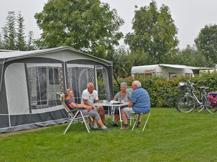
3927 CV Renswoude -
Beauforthuis
Beauforthuis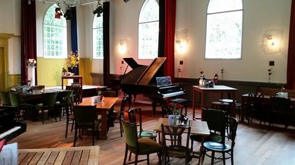
3711 AB Austerlitz -
TOP Rhenen-Center
TOP Rhenen-Center
3911 LD Rhenen -
Castle Groeneveld
Castle Groeneveld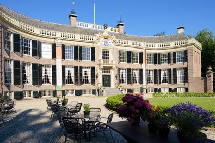
Groeneveld 2
3744 ML Baarn -
Eethuys-Café De Generaal - Baarn
Eethuys-Café De Generaal - Baarn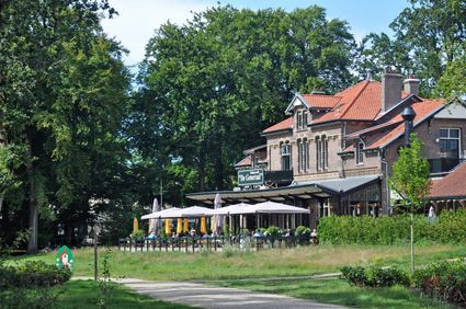
3743 JL Baarn -
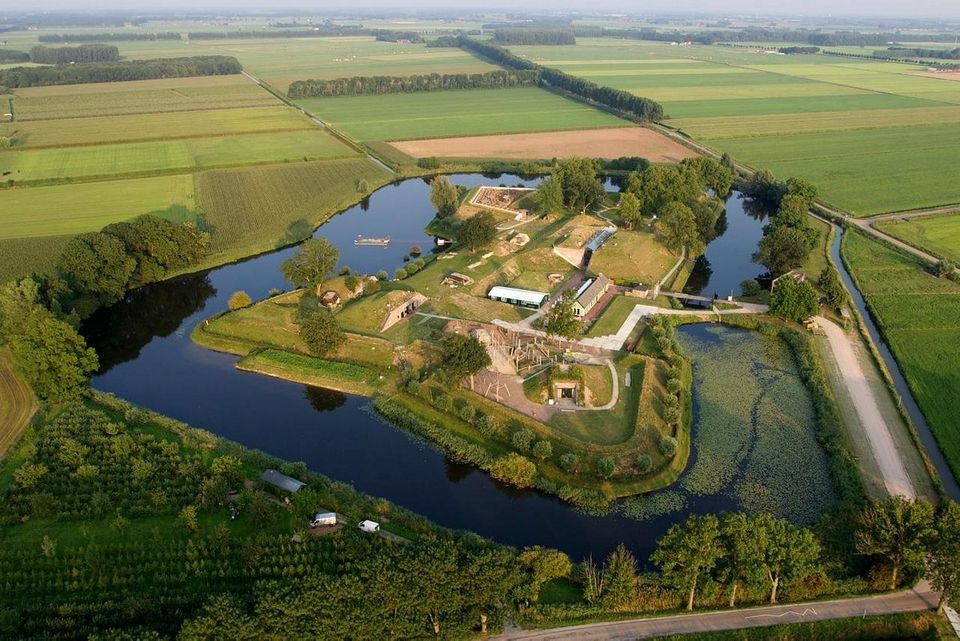
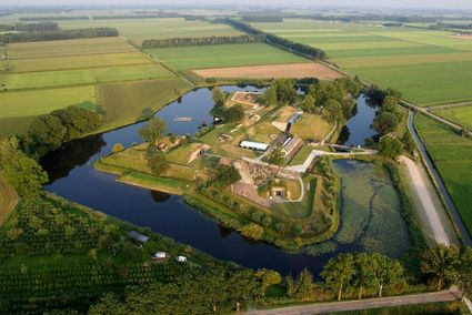
Geofort
Geofort
Explore the exciting old fort island at GeoFort. Plenty of experiments await both inside and outside: wander the dark subterranean tunnels, make your way through the maze or use the lift to descend 6,000 kilometres into the earth. Use the maps to find your way around the virtual Minecraft world or visit the virtual sandpit, where you can make a volcano erupt! Feel like having a break? Our pancake restaurant, De WereldPan, has an extensive food and drinks menu.
Geo
Nieuwe Steeg 74
4171 KG Herwijnen -
-
Culture Factory
Culture Factory
3901 TP Veenendaal -
Café-Restaurant De Lage Vuursche
Café-Restaurant De Lage Vuursche
3749 AD Lage Vuursche -
TOP Linschoten
TOP Linschoten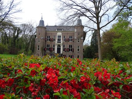
Noord Linschoterdijk 1 (tegenover nr. 1)
Linschoten -
TOP City harbour Wijk bij Duurstede
TOP City harbour Wijk bij Duurstede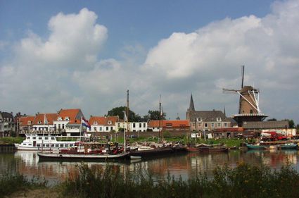
Havenweg
3961 AW Wijk bij Duurstede -
Fort Spion
Fort Spion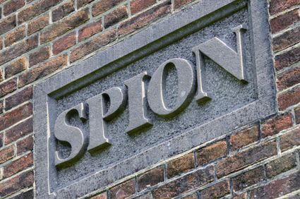
Bloklaan 9a
1231 AZ Loosdrecht -
Fort Nigtevecht
Fort Nigtevecht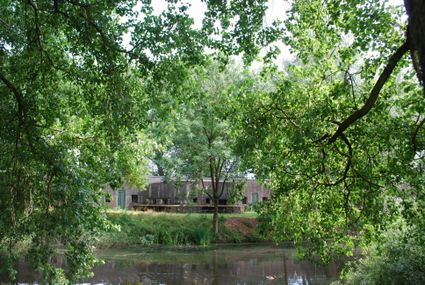
Velterslaan 1
1391 HV Abcoude -
Stayokay hostel Utrecht-Bunnik
Stayokay hostel Utrecht-Bunnik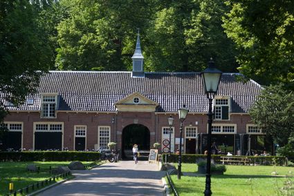
3981 HH Bunnik -
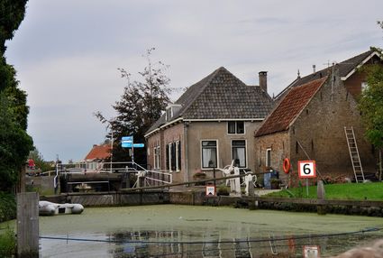
Goejanverwelle lock
Goejanverwelle lock
The Goejanverwelle lock and the Enkele Wiericke lock on the Hollandse Ijssel played a key role in the Disaster Year. Together with the lock at Nieuwerbrug on the Oude Rijn, they formed the inlet to the Langeweide polder, which was the narrowest section of the Waterline. The locks were opened on 17 June 1672 – just in time to halt the advance of the French, who had already captured Oudewater and marched right up to the edge of the hastily flooded Waterline. With great promptitude, the commander of the garrison at Goejanverwelle, the Count of Horn, gave the order to raise sconces and fortifications to defend the locks. For the moment, the Waterline was safe!
3467 PR Hekendorp -
-
Sterkenburg Castle
Sterkenburg Castle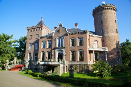
3972 ND Driebergen-Rijsenburg -
Fort Nieuwersluis
Fort Nieuwersluis
3631 AA Nieuwersluis -
The old St. Nicholas Church
The old St. Nicholas Church
3401 BM IJsselstein -
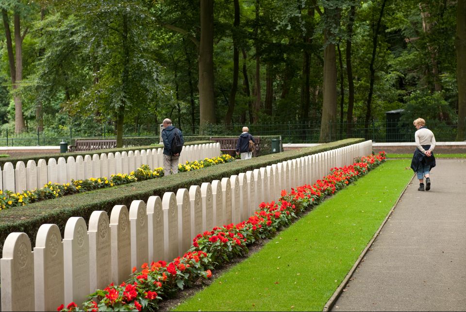
Grebbeberg Military Cemetery
Grebbeberg Military Cemetery
The largest battle of the Dutch army in WWII took place on Grebbeberg Hill. Here poorly armed and untrained men held their ground against a very powerful and ruthless opponent for three days. Grebbeberg Military Cemetery is the final resting place for more than 800 soldiers and 1 citizen who perished here in the Second World War. It is located on Grebbeberg Hill at Rhenen, and was a battlefield of just a few square kilometres, but is full of stories of the courage of desperation in the Netherlands.
The information centre, with an exhibition about the events on Grebbeberg Hill during “The Battle for Grebbeberg Hill” in May 1940, is open daily from 9:00 am to 5:00 pm.

3911 AV Rhenen -
-
Vianen
Vianen
Vianen -
Museum Hoge Woerd
Museum Hoge Woerd
Hoge Woerdplein 1
3454 PB De Meern