odp
193 to 216 of 298 locations
-
TOP citypark Oudegein
TOP citypark Oudegein
3432 NE Nieuwegein -
Zeisterbos
Zeisterbos
3708 BR Zeist -
Spakenburg Harbour Museum
Spakenburg Harbour Museum
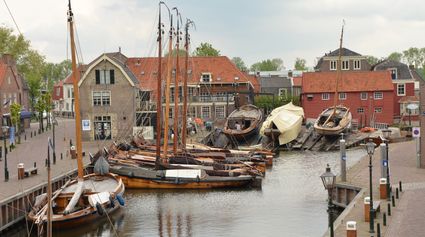
The Old Harbour, also known as the Harbour Museum, dates back to the 13th century. This harbour was built for the ships operated by the Zuiderzee fishermen.
Tap into the history of the fishing village of Spakenburg. Pay a visit to the museum harbour, where culture and traditions come together. Here you’ll find the oldest shipyard in the Netherlands where shipwrights are still hard at work every day, maintaining the world’s biggest fleet of ‘botters’, a special type of wooden, flat-bottomed fishing boat.
In the port of Spakenburg, you'll experience both culture and tradition. The jewel of Spakenburg's port – a museum in its own right – is the oldest shipyard in the Netherlands. From the port, you can see the shipbuilders at work. One-third of the entire Dutch fleet is moored at Spakenburg and you are welcome to come aboard!
3752 AH Bunschoten-Spakenburg -
Henschoter lake
Henschoter lake
3931MK Woudenberg -
National Glass Museum & Glass studio
National Glass Museum & Glass studio
4142 LD Leerdam -
Groene Entree & recreatie Doornse Gat
Groene Entree & recreatie Doornse Gat
3941 MN DOORN -
Fort Blauwkapel
Fort Blauwkapel
3566 MK Utrecht -
Naarden Vesting
Naarden Vesting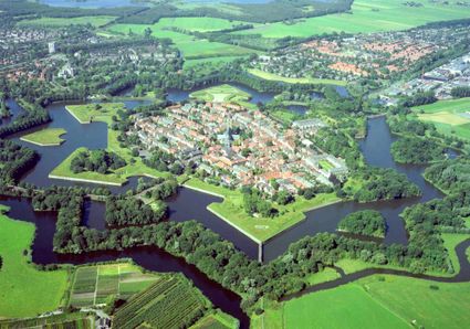
Ruijsdaelplein 10
1411 EA Naarden-Vesting -
The Witches Weighhouse
The Witches Weighhouse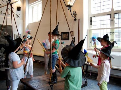
3421 AC Oudewater -
Lock at Cothen
Lock at Cothen
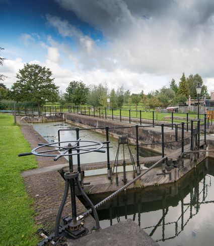
The water board uses the dam in the Kromme Rijn in Cothen to regulate the flow of water to and from Utrecht. The monumental lock alongside it (from 1865) was used during wartime to move ships past the dam. When the Waterline needed to be flooded, the commander of the inundation station at Wijk bij Duurstede first gave the order to raise the water level in the Kromme Rijn by closing off the lock with stop logs. Next, he ordered the stop logs to be removed so that a large body of water could flow from the open lock to Utrecht.
3945BN Cothen -
Pyramid of Austerlitz
Pyramid of Austerlitz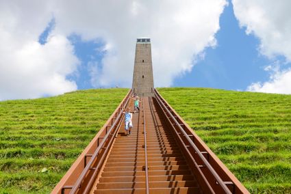
3931 MG Woudenberg -
Muiden
Muiden
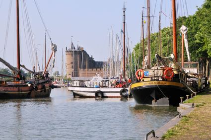
The best way to experience the convivial fortified city of Muiden is to take a stroll by the harbour with its many traditional sailing boats or to settle down at an outdoor café with a view of the Groote Zeesluis. Alternatively, you can explore the fort island of Pampus or visit the centuries-old Amsterdam Castle Muiderslot. Along with Naarden and Weesp, the fortified city of Muiden played an important role. Muiden closed off the Zeedijk dyke and protected the sea and inundation locks of the Vecht. Fort C, also popularly known as ‘the Muizenfort’, has a small museum about the New Dutch Waterline and the Defence Line of Amsterdam.
Herengracht
1398 AA Muiden -
Nederlands Zilvermuseum
Nederlands Zilvermuseum
2871 CZ Schoonhoven -
Hotel Landgoed Zonheuvel****
Hotel Landgoed Zonheuvel****
3941 EP Doorn -
Inundation lock at Wijk bij Duurstede
Inundation lock at Wijk bij Duurstede
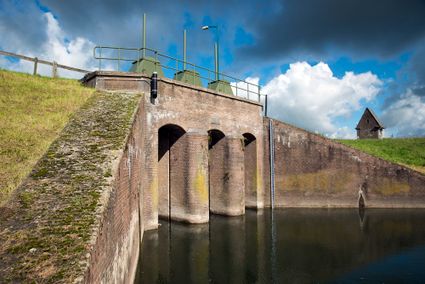
In 1870, the Kromme Rijn was given a key role in the New Dutch Waterline. Back then, it took almost a month to flood the area around Utrecht. This had to be speeded up. To this end, the river was widened, its bends were straightened and locks and dams were built. Near Wijk bij Duurstede, a large inundation lock was built that made Wijk bij Duurstede the ‘tap’ with which to turn on the New Dutch Waterline. This reduced the time needed to flood the inundation areas to between 4 and 12 days. The inlet is still used daily to transport fresh water to the city of Utrecht and the river Vecht.
3961CH Wijk bij Duurstede -
Asschatterkeerkade


Accept cookies to see this content.
Asschatterkeerkade
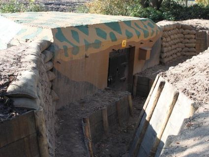
The Asschatterkade dates from 1745, and is one of the longest trenches of the Grebbelinie, with its length of 2500 metres. The trench from 1799 lies east of Leusden, at the edge of the flood plain. But there are also elements from more recent history which can be found.
The nine visible military bunkers, for example, were built during the mobilisation between 1939-1940. There is also a unique concrete tank barrier from this time. During the May Days of 1940, the Germans attempted in vain to break through the defences.
3831 JP Leusden -
Wilhelmina city park
Wilhelmina city park
3581 NP Utrecht -
Nationaal Bomenmuseum Gimborn
Nationaal Bomenmuseum Gimborn
3941 BZ Doorn -
Windmill Windhond
Windmill Windhond
3447 GR Woerden -
Brouwerij Maximus
Brouwerij Maximus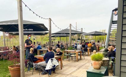
3454 NA Utrecht -
Schaapskooi Heidestein
Schaapskooi Heidestein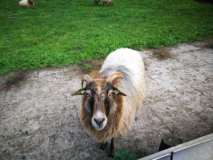
Zeist -
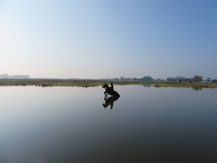
Blokhoven inundation area
Blokhoven inundation area
The Blokhoven polder flood plain is situated behind the Achterdijk in Schalkwijk. During heavy rainfall, it can collect up to 23,000 m3 of water to prevent Schalkwijk from being flooded. This volume is equivalent to around 10 Olympic swimming pools. The area is at the heart of the New Dutch Waterline. In the summer, the plain is flooded twice a month to illustrate the inundation principle for visitors. If heavy or prolonged rainfall is forecast, the water board may decide to forego the inundation, as the plain will be needed to collect excess water.
3998 NE Schalkwijk -
Castle Slot Zuylen
Castle Slot Zuylen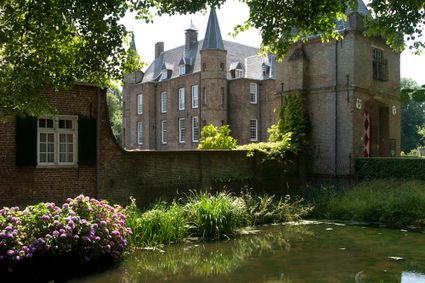
3611 AS Oud Zuilen -
Fort Werk aan de Groeneweg
Fort Werk aan de Groeneweg
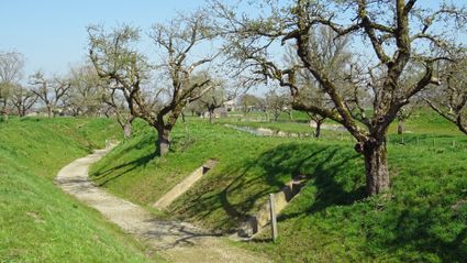
Walking through the historic trenches of Werk aan de Groeneweg is like a walk back in time. The defence structure still has its original configuration. The infantry set-up in World War One consisted of a double trench with earthen walls, 55 group shelters and lovely fruit trees.
The grounds are a fantastic playground for children. You can have a great time here roaming around, crawling through a trench, playing hide and seek and participating in an exciting search and experience walk of about 2 km, with soldier Vendrik as your guide.
3998 Schalkwijk

